


GadgetWings
Drone captures detailed coastal maps
The YellowScan Navigator can produce accurate 3D models of underwater terrain, where traditional methods often struggle.
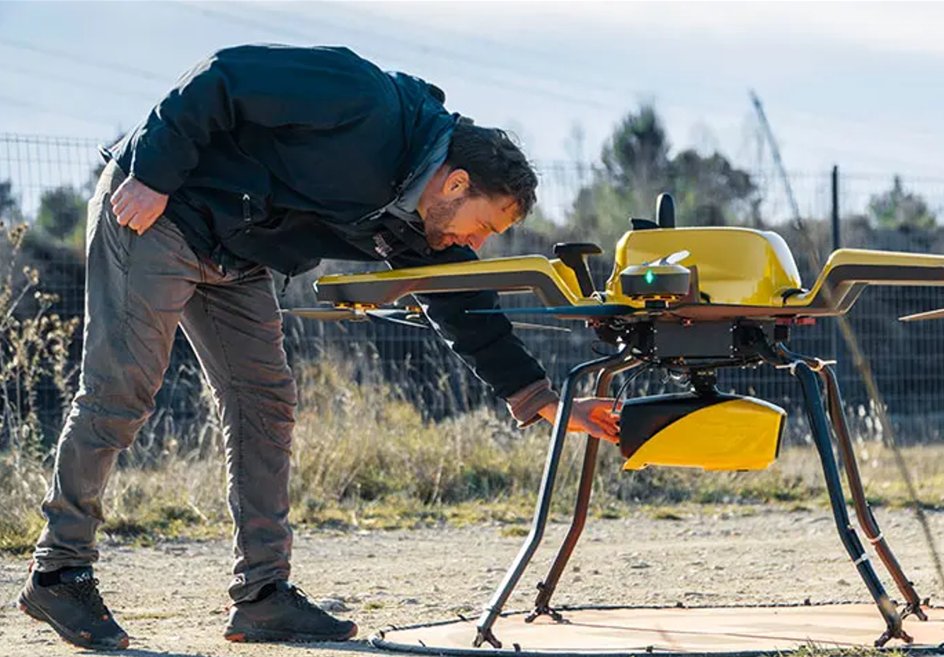
YellowScan has launched a topo-bathymetric mapping system, which uses drones to capture detailed 3D maps of both land (topography) and shallow underwater terrain (bathymetry).
The Navigator uses LiDAR (light detection and ranging) technology with a green laser to penetrate water surfaces and generate accurate 3D representations of underwater terrain.
The system is specifically designed for mapping shallow waters, where traditional techniques, such as sonar on boats, pose navigation safety concerns. This makes it well-suited for environmental monitoring in areas like rivers, coastlines, and wetlands.
Photo supplied.
Weighing 3.7 kg, it is compatible with professional drones and can map shallow waters up to 20 metres deep in optimal conditions, producing digital models with an accuracy of approximately 3 cm.
The Navigator features:
- Miniaturised high-precision sensor technology.
- Mapping shallow waters from a drone where traditional techniques cannot operate.
- Adaptive signal processing capabilities for challenging water conditions.
Precision in climate change monitoring
YellowScan says the Navigator is a critical tool for monitoring and understanding the complex environmental transformations driven by climate change. By providing researchers and policymakers with a window into ecological dynamics, it enables informed decision-making in the face of environmental challenges.
Environmental applications of Navigator include:
- Tracking coastal erosion and sediment movement with centimetre-level precision.
- Monitoring underwater biodiversity habitats.
- Assessing coral reef degradation.
- Evaluating sea-level rise impact zones.
- Documenting changes in marine ecosystems.
“Years of development and distillation of knowledge were necessary to create YellowScan Navigator”, says YellowScan CEO Tristan Allouis. “This technology is transforming abstract climate change discussions into concrete, measurable data.”
YellowScan says the Navigator can improve several sectors:
- Environmental research: Enhancing data collection and analysis for accurate environmental assessments.
- Marine conservation: Providing precise mapping and monitoring to protect marine ecosystems.
- Coastal protection strategies: Supporting the development of effective strategies to mitigate coastal erosion and flooding.
- Climate migration planning: Assisting in the identification of vulnerable areas and facilitating informed planning for climate-induced migration.
- Infrastructure development: Enabling efficient planning and management of infrastructure projects with detailed spatial data.
- Scientific exploration: Offering new tools for researchers to explore and understand complex natural environments.
* Visit the YellowScan website here.


